NEW ZEALAND'S LEADING PROVIDER OF MOBILE LiDAR PRODUCTS & SERVICES
Services
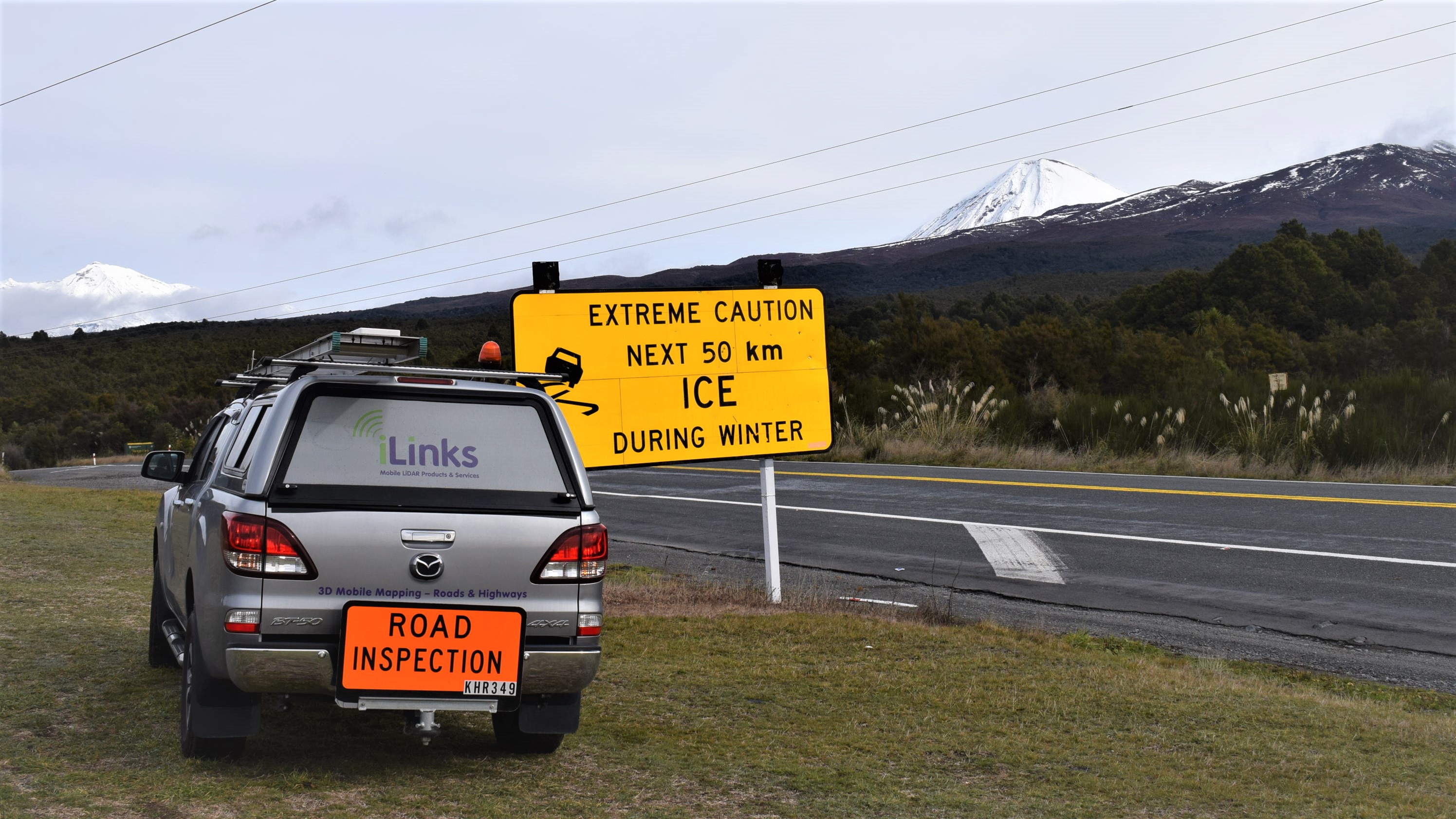
iLinks Limited is a niche provider of vehicle mounted Mobile LiDAR Scanning (MLS) Services to leading Contractors and Consultants in the Road & Highway Industry.
Our Services include:
- LiDAR data capture: data capture using vehicle mounted or fixed LiDAR scanning systems
- Photogrammetry: AUV based options
- Data processing: Creation of registerd point clouds, elevation/bare earth models, cross profiles, feature extraction and 3D models.
Since 2017 iLinks has completed more than 900km of road & highway surveys with no safety incidents.
Download iLinks NZ Project list in kml format
iLinks utilise the InteLAS HD™ (Integrated Laser Aquisition System) which represents the very latest in dynamic geospatial data collection technology. Delivering up to 700,000 data points per second, the system provides a comprehensive, accurate representation of a surveyed area at highway speeds.

 Applications
The INTELAS HD™ systems ability to operate at highway speeds makes the system ideally suited to support Road & Highway infrastructure applications
- Project planning: Topographic mapping, roadway analysis, environmental studies, general measurements
- Project development: Feature extraction for CAD models & baseline data, virtual 3D design, alternatives & clash detection
- Asset management: Modelling, inspection and inventory mapping
- Construction: As-built/repair documentation, post-construction quality control, pavement smoothness/quality determination, quantities and disability access
- Maintenance: Drainage/flooding, vegetation management, bridge inspections, and power line clearance
- Operations: Clearance surveys, land use/zoning, Building and Bridge Information Modelling (BIM/BrIM), traffic congestion and parking utilisation
Benefits
Our services offer significant advantages over conventional survey techniques
- Improved employee and public safety: Conventional survey method place surveyors on the road or highway to take measurements, therefore placing them in danger. Conventional methods may also require that the road may be closed and or subject to traffic management, increasing the safety risk to the driving public. The InteLAS HD™ enables surveys to be conducted at normal traffic speeds thus minimising the need for surveyors to be placed in harms way and negating the need for traffic management.
- Superior data quality and quantity: The iLinks InteLAS HD™ typically captures 400,000 points per second which ultimately provides a more comprehensive and accurate representation of the surveyed area. GNSS post processing combined with local ground control ensures our LiDAR data achieves NZTA Z16 specifications.
- Simplified logistics: By reducing the need to close roads or highways for survey, Clients will not be required to produce Temporary Traffic Management Plans.
- Significantly faster more flexible data capture: Utilising the iLinks InteLAS™, MLS surveys can be performed at normal road speeds resulting in signifiicantly compressed project schedules. A single 60km of state highway can be completed in couple of hours. We can also collect LiDAR data both day and night which significantly increases the operational window and flexibility.
- Significantly improvements in cost:
- The significant saving in time during field operations, hours versus weeks, results in tremendous savings at the data collection phase.
- Removes the cost of Temporary Traffic Management from the project budget. For most projects cost of Temporary Traffic Management is likely to be higher than the cost of the MLS campaign.
- Simplified logistics reduces Project Planning costs and time.
- Cost effective MLS surveys can be undertaken at the feasibility stage of a project to minimise project risk.